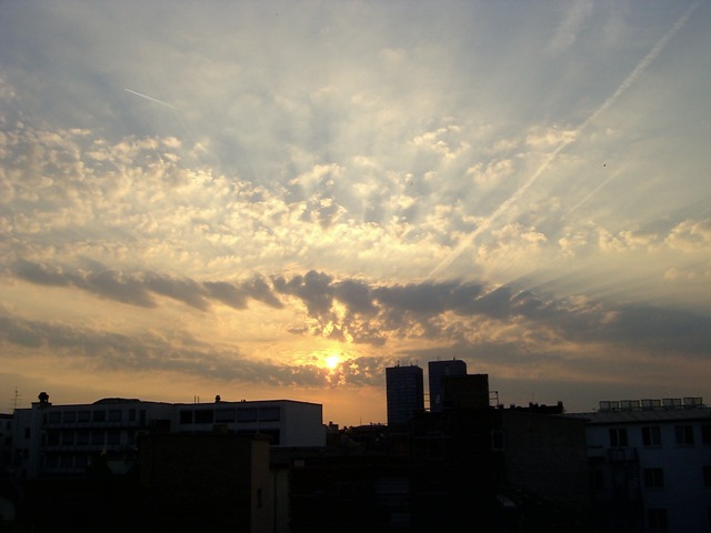
Altocumulus floccus
Altocumulus floccus Ac flo
Genus Altocumulus, Species floccus
- Photo
- Stefan Bauer
- Location
- Mainz
- Taken
- 29 April 2007
An Altocumulus with a tufted structure is called Altocumulus floccus.
The weather that day
Large-scale weather pattern
High over the Norwegian Sea and Fennoscandia, anticyclonic HNFa
An extensive high from the Norwegian Sea to Scandinavia, with winds from the north-east to east. Mostly dry and cool for the time of year, with cumulus and stratocumulus.
Typical clouds in this pattern: Cumulus, Stratocumulus
The weather pattern describes the flow over central Europe on that day – locally, the sky may have looked different.
Clouds at nearby weather stations
| Station | 6:00 | 9:00 | 12:00 | 15:00 | 18:00 | 21:00 |
|---|---|---|---|---|---|---|
| Frankfurt/Main18 km E | Ac | Ac | Cu Ac | Cu | Cu | Ac Ci |
| Kleiner Feldberg/Taunus29 km NE | base 2,100 m | base 1,800 m | – | – | – | – |
Abbreviations = reported cloud genera, from low to high; grey = only cover in oktas and cloud base reported (automatic measurement or airport report). Each station sees its own sky – not necessarily the cloud in the photo.
Also reported at nearby weather stations: Altocumulus
Measurements that day
- Temperature
- 11.9 to 21.5 °C
- Precipitation
- none measured
Between 19:00 and 21:00 the temperature dropped by 4.0 °C.
Sources: observations and measurements from Deutscher Wetterdienst, the German weather service (CC BY 4.0), Wiesbaden-Auringen (17 km N), Wiesbaden-Biebrich (8 km NW); weather pattern after Hess/Brezowsky from the DWD catalogue GWL-REA. Times in local time.







Write a comment or ask a question about this photo
Every comment is read before it is published. Your email address is only needed for the confirmation link and a short message once the comment is online; it is deleted after that.