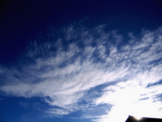
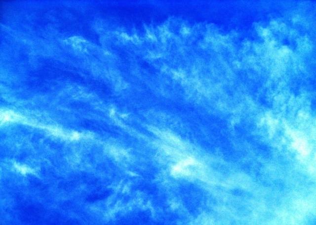
Cirrus floccus
- Photo
- Uwe Reiss
- Location
- Leipzig
- Taken
- 28 November 2007, 13:11
Cirrus clouds, especially in the upper half of the image, take on a tufted appearance: Cirrus floccus.
The weather that day
Large-scale weather pattern
Anticyclonic westerly Wa
High pressure over southern Europe extends into central Europe while lows pass far to the north. Mostly dry, warm in summer and mild in winter; the north is sometimes brushed by cloud bands of decaying fronts.
Typical clouds in this pattern: Cumulus, Stratocumulus, Cirrus
The weather pattern describes the flow over central Europe on that day – locally, the sky may have looked different.
Clouds at nearby weather stations
| Station | 6:00 | 9:00 | 12:00 | 13:00 · Photo | 15:00 | 18:00 | 21:00 |
|---|---|---|---|---|---|---|---|
| Leipzig-Holzhausen6 km SE | base 1,170 m | base 810 m | Ac | Ac Ci | Sc Ci | Ac | Ac |
| Leipzig/Halle14 km NW | Sc | Sc | Ac Ci | Ac Ci | Ac | Ac Ci | Ac |
Abbreviations = reported cloud genera, from low to high; grey = only cover in oktas and cloud base reported (automatic measurement or airport report). Each station sees its own sky – not necessarily the cloud in the photo.
Also reported at nearby weather stations: Cirrus
Measurements at the time of the photo
- Temperature
- 4.4 °C · Dew point 0.1 °C
- Humidity
- 74 %
- Wind
- from the south-west, 9 km/h (Beaufort 2)
- Precipitation
- none measured
Air pressure fell by 1.6 hPa in the three hours before the photo was taken.
Sources: observations and measurements from Deutscher Wetterdienst, the German weather service (CC BY 4.0), Leipzig-Holzhausen (6 km SE); weather pattern after Hess/Brezowsky from the DWD catalogue GWL-REA. Times in local time.

Write a comment or ask a question about this photo
Every comment is read before it is published. Your email address is only needed for the confirmation link and a short message once the comment is online; it is deleted after that.