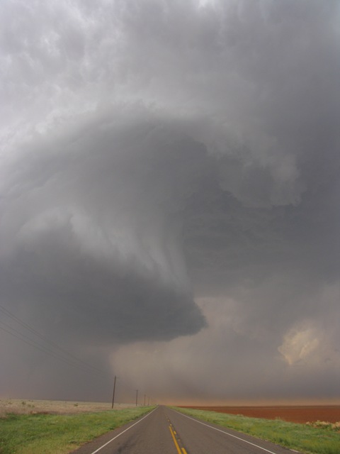
Cumulonimbus arcus
Cumulonimbus arcus Cb arc
Genus Cumulonimbus, Supplementary feature arcus
- Photo
- Janek Zimmer, Website
- Location
- Lamesa, Texas, USA
- Taken
- 5 May 2006
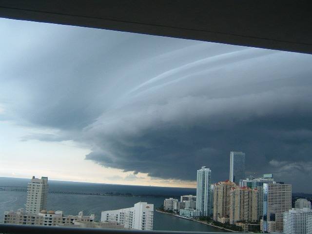
This gust front at the base of a supercell in the USA is called a Cumulonimbus arcus. Above it, there is also a wall cloud, which, unlike the gust front, is characterized by an updraft region.
The weather that day
The sky at nearby weather stations
In the photo: Cumulonimbus arcus
6:00 · Montgomery Field Airport · 12 km NW · instrument
High
no data
Middle
no data
✓ observed · station up to 20 km / up to 50 km / further · ●●● likely · ●●○ quite possible · ●○○ possible
Photo also in the photo
9:00 · Gillespie Field Airport · 8 km NE · instrument
High
no data
Middle
no data
✓ observed · station up to 20 km / up to 50 km / further · ●●● likely · ●●○ quite possible · ●○○ possible
Photo also in the photo
12:00 · Gillespie Field Airport · 8 km NE · instrument
High
no data
Middle
no data
✓ observed · station up to 20 km / up to 50 km / further · ●●● likely · ●●○ quite possible · ●○○ possible
Photo also in the photo
15:00 · Gillespie Field Airport · 8 km NE · instrument
High
no data
Middle
no data
✓ observed · station up to 20 km / up to 50 km / further · ●●● likely · ●●○ quite possible · ●○○ possible
Photo also in the photo
18:00 · Montgomery Field Airport · 12 km NW · instrument
High
no data
Middle
no data
✓ observed · station up to 20 km / up to 50 km / further · ●●● likely · ●●○ quite possible · ●○○ possible
Photo also in the photo
21:00 · Montgomery Field Airport · 12 km NW · instrument
High
no data
Middle
no data
✓ observed · station up to 20 km / up to 50 km / further · ●●● likely · ●●○ quite possible · ●○○ possible
Photo also in the photo
As under “Identify”: ✓ = reported by a weather station, dots = estimated from height and cover (automatic measurement). The stations see their own sky – not necessarily the cloud in the photo.
Measurements that day
- Temperature
- 13.0 to 18.0 °C
- Precipitation
- none measured
Sources: weather reports from the Integrated Surface Database of NOAA (NCEI), Gillespie Field Airport (8 km NE), Montgomery Field Airport (12 km NW). Times in local time.

Write a comment or ask a question about this photo
Every comment is read before it is published. Your email address is only needed for the confirmation link and a short message once the comment is online; it is deleted after that.