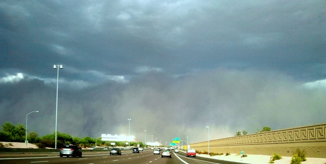
Sandstorm
Visible: Sandstorm
- Photo
- John Calder
- Location
- Phoenix, Arizona, USA
- Taken
- 21 July 2012, 17:30
A powerful sandstorm rolls towards Phoenix like a roller. These sandstorms occur when dust is lifted in arid regions and transported over long distances. Up to 100 million tons of sand can be contained in such dust clouds (Source: Wikipedia).
The weather that day
The sky at nearby weather stations
In the photo: · 18:00
As under “Identify”: ✓ = reported by a weather station, dots = estimated from height and cover (automatic measurement). The stations see their own sky – not necessarily the cloud in the photo.
Measurements at the time of the photo
- Temperature
- 41.0 °C · Dew point 17.0 °C
- Humidity
- 25 %
- Wind
- from the south-east, 52 km/h (Beaufort 7)
- Precipitation
- none measured
Between 17:00 and 19:00 the temperature dropped by 10.0 °C.
Sources: weather reports from the Integrated Surface Database of NOAA (NCEI), Phoenix Sky Harbor Intl Airport (7 km E); ERA5 reanalysis by Copernicus/ECMWF (CC BY 4.0) via Open-Meteo. Times in local time.
Write a comment or ask a question about this photo
Every comment is read before it is published. Your email address is only needed for the confirmation link and a short message once the comment is online; it is deleted after that.